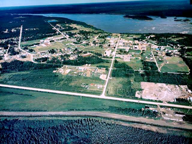
Fort Smith is located on the Slave River south of the “Rapids of the Drowned” and immediately north of the Northwest Territories/Alberta border at 60°00’N and 111°53’W, 322 air km southwest of Yellowknife.
By 1870, the Cree occupied the Slave River Valley after driving the Slavey northward. The Caribou Chipewyan had also moved into the area, and signed Treaty No. 8 in 1899. In 1874, the Hudson’s Bay Company established a trading post just north of the present townsite. It’s strategic location provided an important water traffic link between southern Canada and the Mackenzie River. Alexander Mackenzie travelled the Slave River in his quest for a route to the Western Ocean. The Fort was named for Donald Alexander Smith (later Lord Strathcona) CPR President, Hudson’s Bay governor and a member of the first Northwest Territories Council.
|