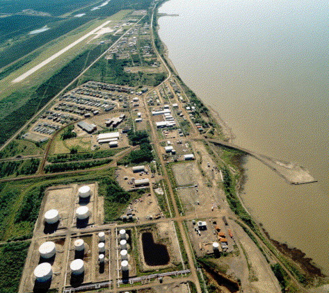
Norman Wells is situated on the Mackenzie River at 65°17'N and 126°50'W, 80 km northwest of Fort Norman and 684 km northwest of Yellowknife.
Norman Wells is the fourth largest, single oil deposit in Canada. Alexander Mackenzie found the first traces of oil during his travels down the River, and an oil bearing formation was found in 1911. By 1937 oil exploration in the area was well established by Imperial Oil Ltd., which constructed an aviation fuel refinery in 1937. Between 1942 and 1944 the Canol Project, which intended to supply fuel for the American war effort in the Pacific, built a pipeline between Norman Wells and Whitehorse, as well as a series of airstrips and winter roads between Fort Simpson and Norman Wells. |