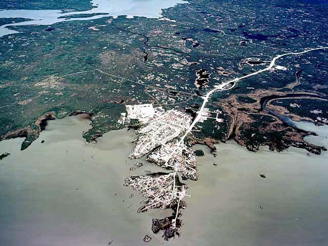
| Rae is located on the North Arm of Great Slave Lake at 62°50’N, 116°4’W. A 24-km road joins Rae to its sister community, Edzo (62°40’N, 116°4’W). The communities are approximately 110 km northwest of Yellowknife on the Mackenzie Highway.
The Dogrib have lived in the area for centuries. A trading post was established in the area around 1790. The Dogrib and the Yellowknife Dene historically quarrelled, and access to firearms allowed the Yellowknives to control trade and hunting grounds around Great Slave Lake for 30 years. However, around 1823 both groups agreed to make peace. John Rae opened a Hudson’s Bay Company post in 1852 at Old Fort Rae, approximately 8 km from the present site. The Dogrib signed Treaty No.11 in 1921. Permanent housing arrived in the 1940s and medical care was available from Yellowknife following World War II. Electricity was introduced in 1959 and an access road to the highway was built in 1960. Development of nearby Edzo began in 1965. |